Burkina Faso gained full independence from France on August 5, 1960, as Upper Volta. It changed its name to Burkina Faso in 1984.
Showing posts with label geography. Show all posts
Showing posts with label geography. Show all posts
Monday, August 5, 2024
Upper Volta
Friday, August 2, 2024
Cassini map
The Cassini Map or Academy's Map is the first topographic and geometric map made of the Kingdom of France as a whole. It was compiled by the Cassini family, mainly César-François Cassini (Cassini III) and his son Jean-Dominique Cassini (Cassini IV) in the 1700s. The map was, for the time, a real innovation and a decisive technical advance. It is the first map to be based on a geodesic triangulation. Four generations of the Cassini carried out the work, taking more than 6 decades to complete. Poor Cassini IV was imprisoned by the National Assembly for being royalist, but they still availed themselves of his map.
Saturday, July 20, 2024
Brazil's geography
The northernmost point of Brazil is closer to Canada than it is to its own southernmost points. Also, Brazil's easternmost point is closer to Senegal than it is its own westernmost point.
Thursday, July 11, 2024
Svalbard
Svalbard is a Norwegian archipelago in the Arctic Ocean north of mainland Europe. It lies about midway between the northern coast of Norway and the North Pole. No one is required to have a visa or residence permit on Svalbard. Regardless of citizenship, persons can live and work in Svalbard indefinitely. The Svalbard Treaty grants treaty nationals equal right of abode as Norwegian nationals. The sun doesn't set for five months in summer. It is the home of the Global Seed Vault.
Saturday, December 3, 2022
Mount Cynthus
Mount Cynthus is on the isle of Delos. In myth, it is the birthplace of Apollo and Artemis. They are thus sometimes called Cynthius and Cynthia, respectively. It is about 450 feet high, so not much of a mount, really.
Friday, November 22, 2019
St. Lawrence River
The St. Lawrence River connects the Great Lakes with the Atlantic Ocean. Jacques Cartier arrived there on St. Lawrence's feast day, thus the name.
Wednesday, November 20, 2019
Friday, November 8, 2019
Thursday, April 16, 2015
Mayon Volcano
Mayon Volcano, on the island of Luzon in the Philippines, is known as "the perfect cone" because of its shape.
Tuesday, June 17, 2014
John O'Groats
The thing I learned today is that John O'Groats is a village on the northeast coast of Scotland. It is mentioned in the phrase "from Land's End to John O'Groats," meaning a great distance, as the distance between those two towns (875 miles) is the longest distance between two inhabited points in the UK. It is named for Jan de Groote, a Dutchman who settled there.
Sunday, June 15, 2014
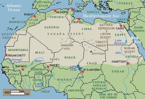
Size of the Sahara Desert
The thing I learned today is that the Sahara Desert is 3.6 million square miles in area, which means it is nearly as large as the United States or China (both around 3.7 million square miles).
Wednesday, June 4, 2014
The Brenner Pass
The thing I learned today is that the Brenner Pass is one of the principal passes over the Alps, and the lowest such pass. It connects Innsbruck, Austria and Verona, Italy. Today it is one of the most important transit routes between northern and southern Europe. It is the site of a few battles and in 1940 Hitler famously met Mussolini there.
Monday, May 5, 2014
The Caspian Sea
The thing I learned today is that the Caspian Sea is not technically a sea, because it does not connect to the ocean, but is considered the world's largest lake (by surface area). However, note that Lake Baikal is the world's largest lake by volume.
Sunday, May 4, 2014
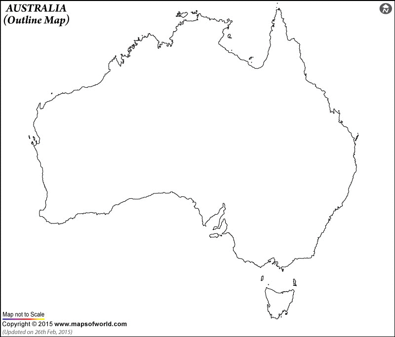
The Tasman Sea
The thing I learned today is that the Tasman Sea is situated between, not (as you might expect) Australia and Tasmania (that's the Bass Strait) but rather Australia and New Zealand.
Saturday, May 10, 2008
Point Nemo
Point Nemo is a name for tthe oceanic pole of inaccessibility, the place in the ocean that is farthest from land. It lies in the South Pacific Ocean, 1,670 miles from the nearest lands: Ducie Island (part of the Pitcairn Islands) in the north, Motu Nui (part of the Easter Islands) in the northeast, and Maher Island in the south. The area is also known as a "spacecraft cemetery" because hundreds of decommissioned satellites, space stations, and other spacecraft have been deposited there upon re-entering the atmosphere. The space station Mir fell there in 2001.
Monday, May 5, 2008
Mount Kenya, the highest mountain in Kenya and the second-highest in Africa, is known in the Gikuyu language as Kirinyaga, which means 'God's resting place.' It is a volcanic peak.
Sunday, May 4, 2008
Pico de Orizaba is the highest peak in Mexico, at 18,490 feet tall. It is a volcanic mountain located on the border of the states of Puebla and Veracruz.
Monday, April 28, 2008
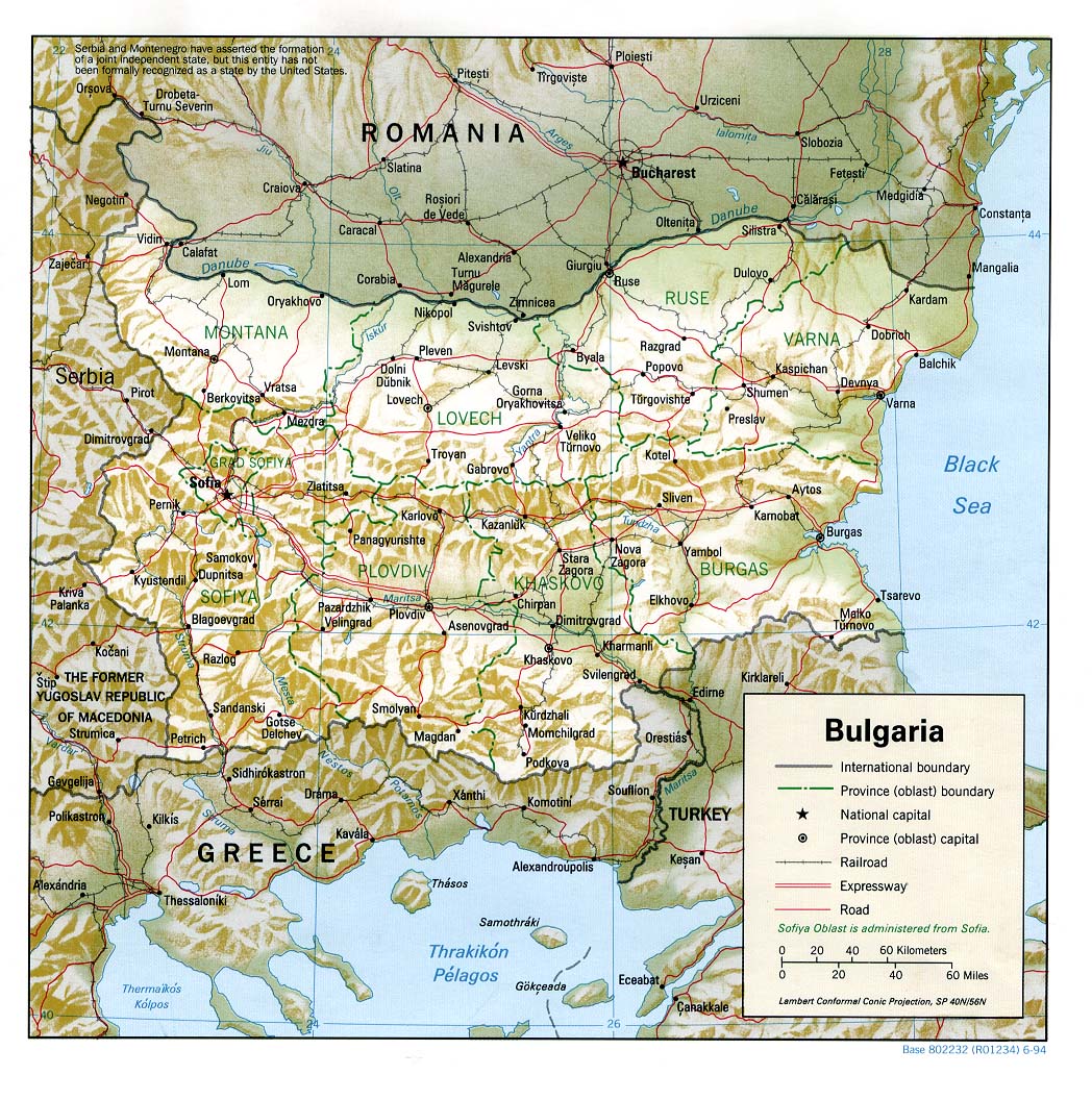
The Iskar River is the longest in Bulgaria, at 230 miles. A tributary of the Danube, it flows near eastern Sofia, the capital.
Saturday, January 5, 2008
Subscribe to:
Posts (Atom)